Badlands Residency Day 45
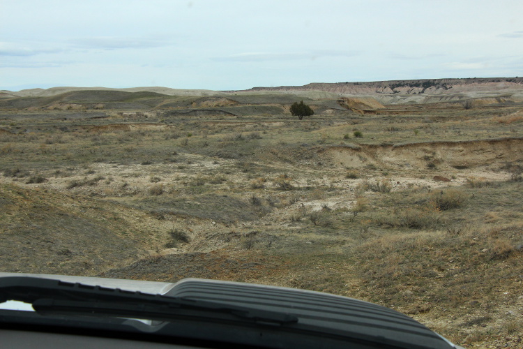
Spent the day down in Stronghold with Ryan. We headed out early and drove out on Cuny Table, following a new road for both of us, that went up to the north west edge of the table. Next we drove to Red Shirt overlook and checked on the garbage situation (there was a serious park cleanup here last month, and people are already dumping more). From there we backtracked down BIA-41 to a turn off that's maybe a couple miles south of Red Shirt. The south unit ranger gave me a wonderful map a couple days ago that was put together by one of the park biologists. It shows all the 'roads' through the Stronghold that aren't on any printed maps. Some you can make out on satellite images. Ryan wanted to try this one road that leads from the table down into the Cedar Creek area. I've been wanting to get down into that region for a while, so was quite excited. Many hours later, we only had progressed about a mile or two. Or at least that how it appears as I sit here now looking at the plotted GPS coordinates on a map. The 'road' we were on was pretty bad, even by south unit standards. Getting down the side of the table was iffy enough that Ryan said there's no way we're going back up that. Might not even get back up that. Steep, loose, and winding through the trees, it was quite lovely. At the base of the table we had some rolling hills of grass and rock to bump up and down, then we were into the chadron formation and looser soil. One of the earlier creek crossings turned out to be a near miss for getting stuck, and we were pretty excited to have made it through. The truck we had out is a huge Chevy with a winch, so it's prepared. Lucky for that, since the next crossing ended up requiring an hour or more long winching operation. And then we had to cross it again, and got stuck again. Full details will be in a separate post to follow.
It was tough and slow going, but we got the truck up and out in several phases of stuck-ed-ness, each with its own problems to solve. About this time, it began to drizzle. This is not the place to be in the rain, so we wasted no time negotiating the creek crossings back over the the base of the road up the table. Going up was indeed trickier than going down, but after the new perspective of our recent winching maneuvers it didn't seem so bad. We did make it, with the vehicle all in one piece.
Drove back to the park, loaded up on gas, dumped off some old tires we found out at Red Shirt, and spent some significant time in the garage, power washing the mud off the truck, off of us, and then off the garage floor. Tomorrow is scheduled to be another day down south, with a group of rangers this time. Of course if it rains or snows over night, that may be off. Fingers crossed!
 |
| Cedar Butte Reflection |
 |
| The edge of Cuny Table. |
 |
| Looking into the distance. |
 |
| Looking down into the heart of the Stronghold. |
 |
| Layers of buttes, Sheep Mountain in far distance. |
 |
| I love the look along Cuny table, with the wide and sharply erosion patterns. |
 |
| Neigh. Grazing land within the National Park. |
 |
| Finger of land stretching into the distance. |
 |
| Harney Peak behind the badlands. |
 |
| Looking deep down into the Stronghold Unit. |
 |
| Skull and Harney. |
 |
| Rim of Cuny table. |
 |
| Rolling grassland at the edge of the sod table. |
 |
| Plenty Star table in the background, a favorite of mine. |
 |
| Cuny table rim and badlands below. |
 |
| Moo. Grazing lands within the National Park. |
 |
| Looking into Stronghold, the dark spots are old car bodies, used as targets when this area was part of the Badlands Bombing Range. |
 |
| Local humor. |
 |
| Unique formations with Sheep Mountain in the distance. |
 |
| Ranger Frum with rig. |
 |
| At the edge of Red Shirt table overlook area. |
 |
| Looking down from Red Shirt overlook. |
 |
| The road down into Cedar Creek. |
 |
| Turkeys! |
 |
| The rig and the road. |
 |
| Almost got stuck, but not quite. |
 |
| In the Cedar Creek area. |
 |
| Butte and road. |
 |
| Fun roads! |
 |
| Another crossing. |
 |
| This time not so lucky. Front tire buried deep. |
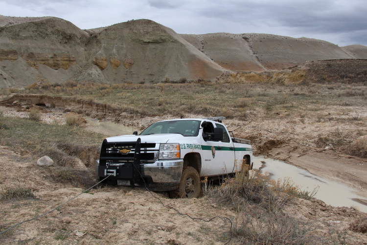 |
| Winching out with a deadman anchor. Got stuck again at this point and used a tree as anchor. |
 |
| The path to freedom. |
 |
| Ryan standing where the front tire had been. It was just a little deep and squishy. |
 |
| Path of redemption from episode #2 of being stuck. |
 |
| The road to the edge of the table where we drive up. |
 |
| Panorama from Cuny Table, NW side. |
 |
| Panorama from Cuny Table, NW side. |
 |
| Panorama from near the Red Shirt Table overlook. |
 |
| Panorama from near the Red Shirt Table overlook. |
Comments
Post a Comment